


2022
Mystic Meadows
I took this drone photography while I was hiking in the Huascarán National Park in the Cordillera Blanca tropical mountains of western Peru.
Hiking
Photography
Intro

Shoutout Kitti and Jon for this wonderful pic
Laguna 69 is a beautiful mountain lake located at the foot of Nevado Chacraraju in Huascaran National Park. This route is often considered the most beautiful day hike in Peru. To get there, you must first go to Yungay, then go up the trail to the Llanganuco valley and pass the two magnificent lakes, and then continue to Cebollapampa, the starting point of the hike. Note that if you go with your own vehicle, you will have to leave it at a place called Yuraq Coral, which will lengthen the route a bit.


The Hike
The hike starts along a large plain and then begins to climb. Quickly, the views of waterfalls and peaks are breathtaking. Among other things, you can see the Huascaran, Peru's highest peak, as well as the Chopicalqui. To access the lagoon, you have to pay an entrance fee to the Huascaran National Park, which is part of this protected area. On arrival, visitors are rewarded with a turquoise lagoon surrounded by glaciers and a breathtaking view that makes all the effort worthwhile
Hike Details
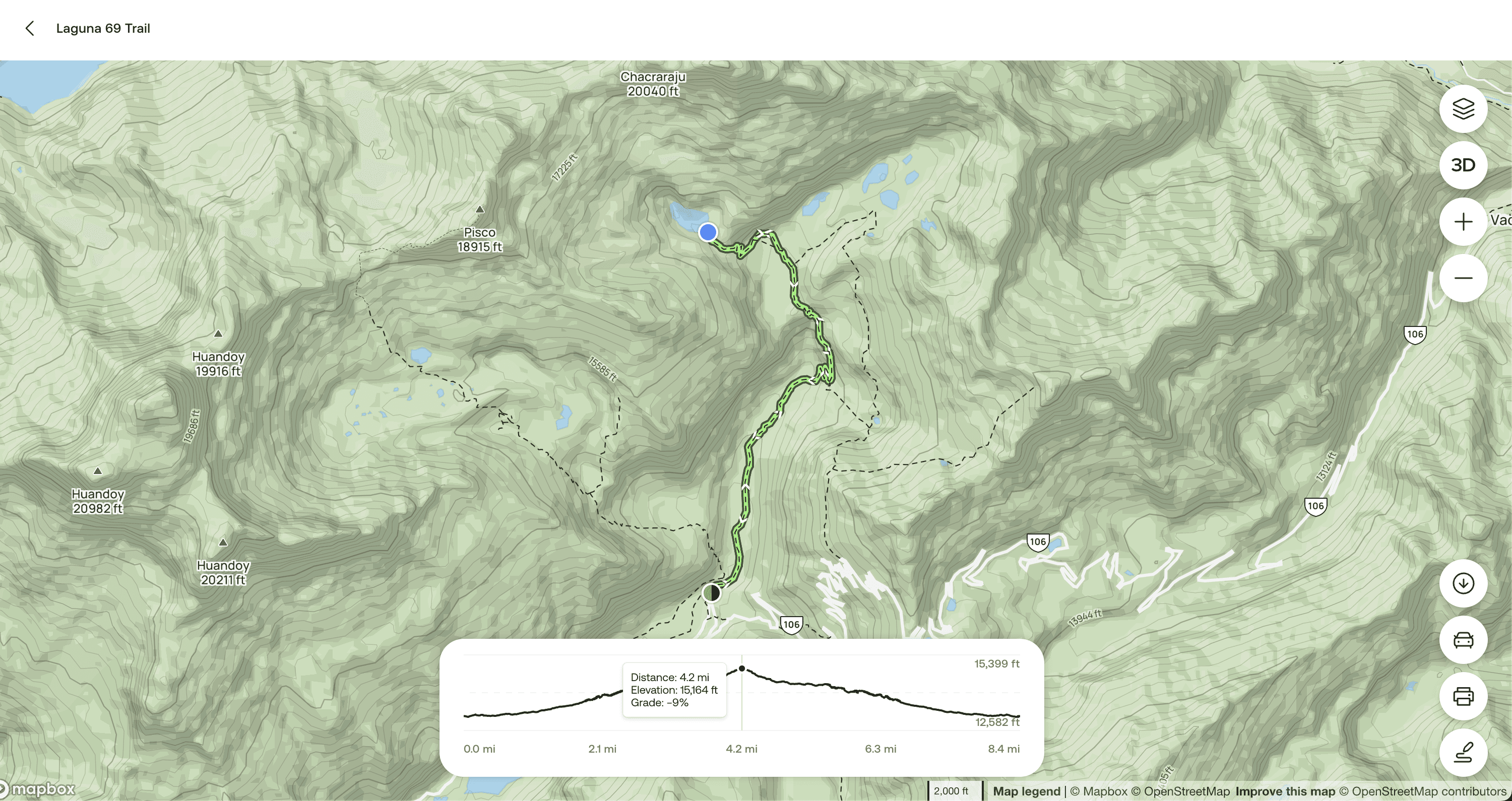
AllTrails map of the Laguna 69 Hike. Laguna 69 Trail is considered a hard hike that covers 8.4 mi, with an elevation gain of 2,696 ft. It takes about 5.5–6 hr to complete. Hard trails usually cover longer distances, and may have long or steep climbs or more difficult obstacles.
8.4mi in Length
2,696ft in Elevation gain
5.5–6hr Estimated time Out & Back

Go Visit!
Truly a breathtaking hike (pun intended), would highly recommend for you to go visit and plan your trip to include this hike if you're looking for an adventure. Check out this full hiking guide from Peru for Less to get all the details on where to stay prior to the hike and tips to fight altitude sickness. Enjoy!

FAQ